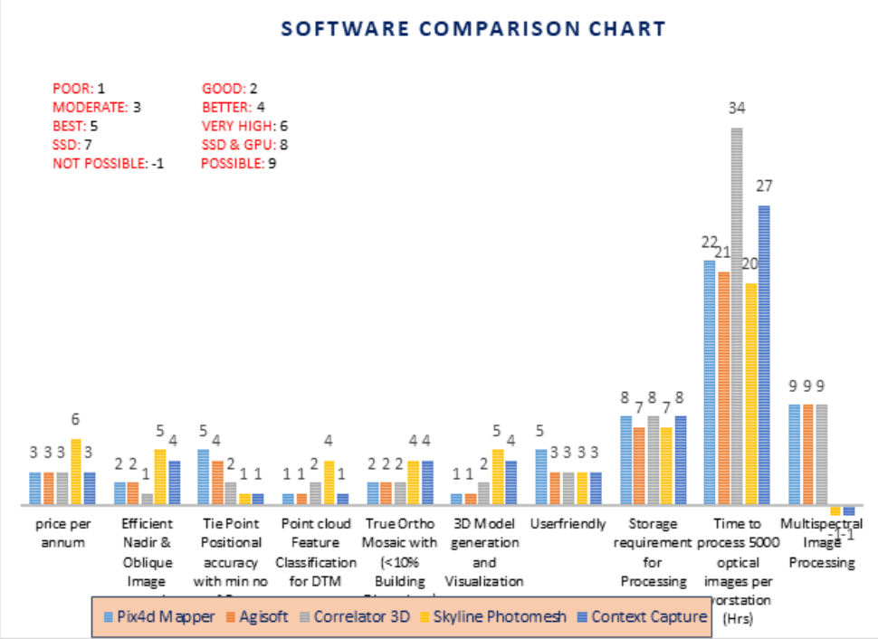
A comparision of data processing softwares for photogrammetry
To extract the information from the Drone Imagery, many Software packages like Pix4dMapper, Agisoft, Correlator 3d, Context Capture, Inpho, Skyline Photomesh, etc have been used in the present world. In order to better understand the capabilities of these software’s, a detailed study has been conducted on the workability and usability of different Drone Data Processing Softwares and the same has been presented here.